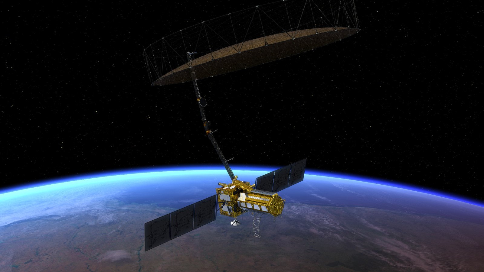
The National Aeronautics and Space Administration (NASA) recently uncovered a “hummingbird” buried in Antarctica via data from the NISAR (NASA-ISRO Synthetic Aperture Radar) satellite. This comes not long after NASA confirmed a satellite image of a U.S. volcano that is “ready to rumble.” But while the latter has alarmed scientists, the agency’s latest Antarctica discovery is actually quite a milestone.
This new image gives scientists an unprecedented look at the mysteries hiding beneath the landscapes of the coldest place on Earth. Here’s a closer look at what NASA’s “hummingbird” find reveals about Antarctica, which is sure to captivate space enthusiasts.
NASA Satellite Uncovers Hummingbird-Shaped Formation Buried In Antarctica
NASA has recently released detailed imagery of a hummingbird-shaped formation in Antarctica, which was captured using NISAR’s L-band Synthetic Aperture Radar (L-SAR) in August 2025. However, the striking combination of colors—magenta, green, and white—is actually artificial. This discovery is a false-color synthetic aperture radar (SAR) map, not a photograph, of a mountaintop in the Prince Charles Mountains of East Antarctica called Nunatak Zaterjavshijsja.
“The colors show differences in the way polarized microwave signals, which vibrate in different directions, interact with and reflect from the ice,” NASA explained in its press release on July 21. “Over Antarctica, NISAR transmits radar waves toward Earth with a horizontal polarization. The orientation of the signals that return—either horizontal, vertical, or both—provides clues about the object or surface that reflected them.”
The release of the image comes as NASA and ISRO (Indian Space Research Organisation) approach the first anniversary of NISAR’s launch from India’s Satish Dhawan Space Centre on July 30, 2025. The mission’s objective is to help experts track disasters, monitor ecosystems and crops, analyze the movements of melting glaciers and ice sheets, and know more about the changes on the Earth’s surface.
It’s why this hummingbird-like map is quite a game-changer, demonstrating how precisely the NISAR satellite can map remote and shifting terrains in the world’s fifth-largest continent, as well as predict future environmental changes. It shows that the topography of the Nunatak Zaterjavshijsja disrupts the ice flow from underneath.
What NASA’s “Hummingbird” Image Reveals About Antarctica
NASA’s “hummingbird” map offers a wealth of structural detail and hidden texture to an otherwise all-white blanket of snow when viewed in optical light. The white in the radar image represents areas in which magenta and green signals “scatter back strongly,” which potentially means there is fair surface and volume scattering. Magenta means the ground is smooth, while green means it is rough and cracked.
“First, it’s a beautiful image, with rich details of features that provide insights into how the glacier is moving. Then, because radar can often see through snow and deep into the ice, NISAR can observe fundamentally different properties of Antarctic ice than can be seen in optical imagery,” said Seongsu Jeong, the signal analysis engineer who produced the image at NASA’s Jet Propulsion Laboratory in Southern California. “With NISAR we’re seeing what’s hidden beneath the surface.”
The Nunatak Zaterjavshijsja is then seen to be rising directly out of an ice stream moving northeast to the ocean. As the moving glacier pushes against this obstruction, the intense pressure fractures ice into deep crevasses, as visualized as the vibrant green lines on the map. This obstacle is not a cause for alarm, and these cracks are not new damage either.

However, NISAR’s ability to map this out so clearly is useful for glaciologists tracking how fast Antarctic glaciers are moving, accurately predicting how they could impact future global sea-level rise. East Antarctica is also the most remote and isolated region on Earth, making it hard to understand the area. With NISAR, detailed maps are generated every 12 days even through winter darkness and thick cloud cover, enabling scientists to monitor it year-round.
Antarctica Is One Of The Hardest Places On Earth To Image From Space
The hummingbird-shaped NISAR satellite map of the Nunatak Zaterjavshijsja is also remarkable due to how Antarctica is historically one of the hardest places on Earth to image from space. The challenges involve severe lighting constraints, extreme environmental conditions, and satellite orbital limitations. NISAR overcomes these traditional hurdles of polar satellite imaging using three primary technological and orbital innovations:
|
Active Dual-Frequency Microwave Radar |
While standard satellites require sunlight to take pictures, NISAR actively transmits its own L-band and S-band microwave radar signals. |
|
Giant 12-Meter Deployable Wire-Mesh Reflector |
The spacecraft has a 39-foot (12-meter) drum-shaped radar antenna reflector, the largest ever launched by NASA. |
|
12-Day Repeat-Pass Interferometric Orbit |
NISAR operates from a fine-tuned polar trajectory that allows it to survey Earth’s land and ice-covered regions every 12 days, tracking even the most subtle centimeter-scale changes in glacier movements. |
The Indian side of the mission has started to release S-band data, as well as the U.S. team with L-band data. The latter is set to release all data from earlier operations by the end of the year. These files will be available for download at the Alaska Satellite Facility Distributed Active Archive Center in Fairbanks, which hosts and distributes all NASA synthetic aperture radar data.